Leatherneck Ridge By Caleb M.
- Posted on
- Posted in San Jacinto
- 0
Caleb M. of Nomad Ventures shares his trip report on hiking the challenging and seldom done, Leatherneck Ridge on the North Side of San Jacinto.

My alarm went off at 2am, and I rolled out of bed, surprisingly eager to start my day and get on Leatherneck Ridge. At this point spirits were still high, and I didn't know what I'd be getting myself in to in the coming hours. My drive out from Hemet put me at the visitors center at 3:30am, 30 minutes before I was set to meet my partner at the visitors center. I tried getting some extra sleep, but couldn't manage any, probably all the nerves and excitement.
Finally it turned 4, and I met my partner in the parking lot of the visitors center, ready to begin. Despite it being November, it still felt disappointingly hot and humid, a not so reassuring thing to start the day. The first mile or so took us cross country across open flat desert, we were still at 700ft above sea level. As we crested a small hill, I looked to my left and caught reflective tape attached to a tent, and not wanting to get stabbed by someone thinking I'm invading their home, we quickly picked up the pace to put some distance between us. We finally reached the base of the mountain around 4:30am, and began a slow but steady scramble up the hillside, quickly gaining in elevation and leaving the warm desert floor behind us.

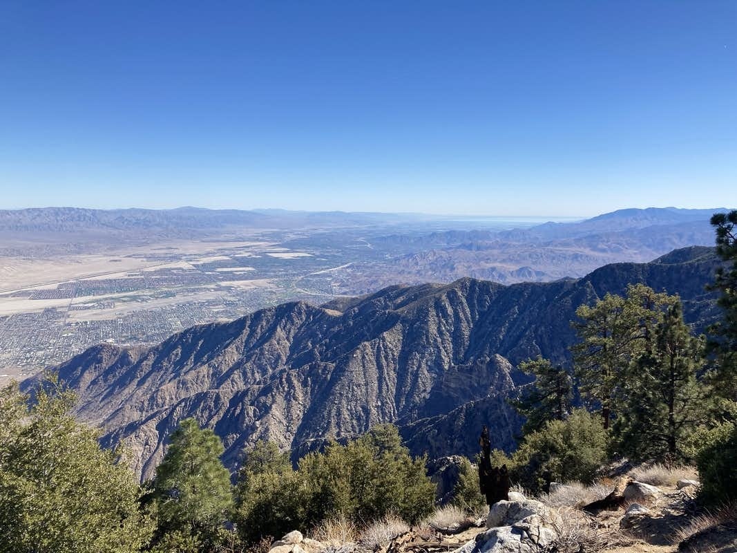
The first 2000 feet were really steep, and we hadn't even gained true Leatherneck Ridge yet, and it was around this time that I realized I didn't have nearly enough water, and I'd have to start conserving. Around 2,500ft we were welcomed to an amazing desert sunrise, and we finally were able to see the ridge we'd eventually be following. Let me tell you, it looked brutal, and I would soon find out it was. The next 2k feet were relatively uneventful, just a long slog in unimpressive terrain. Around 4500ft we started to see the treeline, and the hill we had to gain to get to the treeline. It was at this point we also started encountering thick, impenetrable brush, and it slowed us down some. The hill to the treeline ended up being worse than it looked, and I was now suffering from mild dehydration, and needed to eat. We had to push through brush and ended up gaining something like 2500 feet in a mile, so an absolutely miserable time.

Finally, treeline. Or so I thought. We finally began to scramble on class 3 and maybe some class 4 terrain. The one thing keeping me going was the views, skyline ridge to the east, Snow Creek and Dry Falls to the west, and San Gorgonio and its sister peaks to the North. By this point I had less than a liter of water, and although I only started with 2 liters I was conserving so I was having a hard time with dehydration and hunger and it definitely didn't help that it was hot and exposed the entire ridge. Nearing the top, it gets steeper and steeper, and we were having to drop in elevation to just gain it right back. Talk about a miserable slog. The final push to Shangri La was absolutely miserable, and I was on my last leg, I was now out of water and still just as hungry. We topped out at 2pm, and now just had a short mile hike back to the tram station, and upon arriving I downed water at the fountain, thank god for modern amenities. A short tram ride down we were back at the valley floor, tacos in hand, and I was already reminiscing on it and planning on when to do it again. Total on the day was 10 miles, 10k feet of elevation gain, and 11 hours. All off trail.


Comments
Be the first to comment...